Product Links
- PDF (9.1MB) - Static viewing and printing
- SHAPEFILE - Download a Shapefile of data
- WEBMAP - Dynamic viewing in a browser
- GEODATABASE - Download data in the ESRI format
- TABLE - Excel
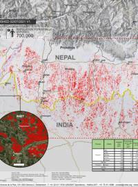
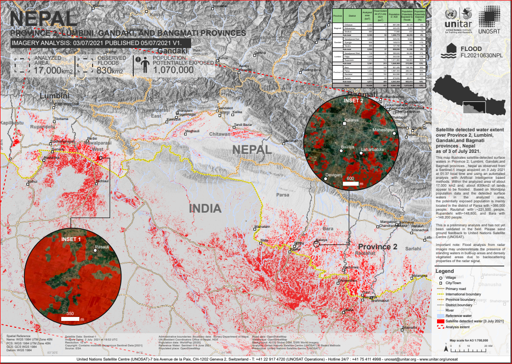
This map illustrates satellite-detected surface waters in Province 2, Lumbini, Gandaki,and Bagmati provinces , Nepal as observed from a Sentinel-1 image acquired on 3 July 2021 at 01:37 local time and using an automated analysis with Artificial Intelligence based methods. Within the analyzed area of about 17,000 km2 and, about 830km2 of lands appear to be flooded. Based on Worldpop population data and the detected surface waters in the analyzed area, the potentially exposed population is mainly located in the district of Parsa with ~386,000 people, Rautahat with ~221,500 people, Rupandehi with~148,800, and Bara with ~148,200 people.
This is a preliminary analysis and has not yet been validated in the field. Please send ground feedback to United Nations Satellite Centre (UNOSAT).
Important note: Flood analysis from radar images may underestimate the presence of standing waters in built-up areas and densely vegetated areas due to backscattering properties of the radar signal.
Satellite Data: Sentinel-1
Imagery Dates: 2 July 2021 at 19:52 UTC
Resolution: 10 m
Copyright: Contains modified Copernicus Sentinel Data [2021]
Source: ESA
Administrative boundaries: Boundary data: Survey Department of Nepal, UN Resident Coordinators Office in Nepal, HDX
Population data: WorldPop [2020]
Reference Water: Sentinel-1/ 8 June 2021
Populated place: OpenStreetMap
Road data: OpenStreetMap
Waterways: OpenStreetMap
Background: ALOS Global DSM, ESRI World Imagery
Analysis: United Nations Satellite Centre (UNOSAT) AI Based Methods
Production: United Nations Satellite Centre (UNOSAT)
Click here