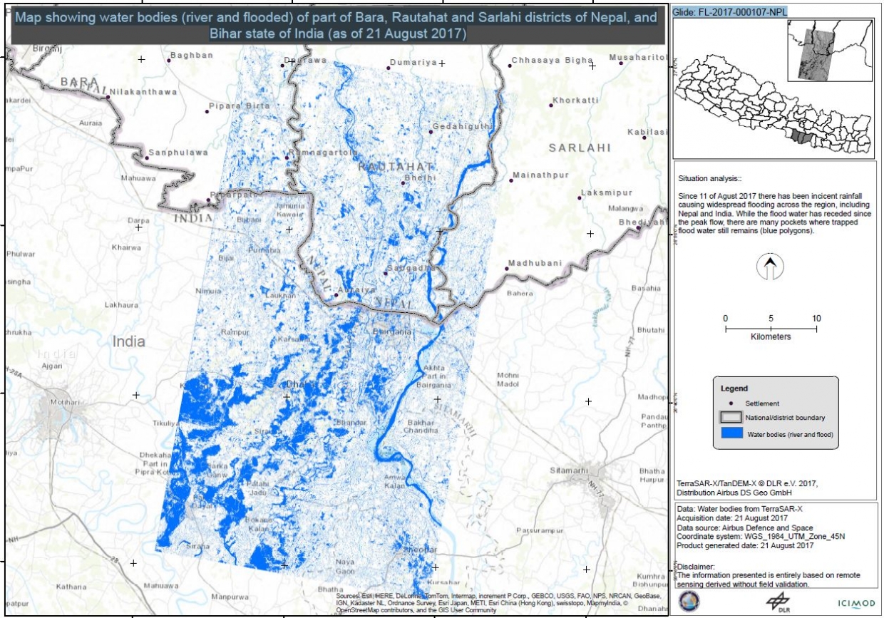
While the flood water has receded since the peak flow, there are many pockets where trapped flood remains (within whilte polygons).
While the flood water has receded since the peak flow, there are many pockets where trapped flood remains (within whilte polygons).